 MAPu
MAPuA map and gauges for your action-camera videos
MAPu takes the GPS data from your camera or a data file, puts speed, altitude, heading, a moving map and a 3D vehicle on the video, and renders the finished film. Everything happens on your computer.
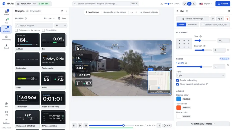
- 74widgets
- 13widget categories
- 6camera sources in the video
- 11data file formats
What it does
Map and 3D
- A moving map — with streets, street names, the route so far and your position, frame by frame; it can turn with your heading.
- Snap to road — a position that GPS noise puts beside the road goes onto the road, with an adjustable tolerance.
- 3D map — with terrain and 3D buildings.
- 3D vehicle on the map — the vehicle's 3D model drives on the real map, with the weather and light of the recording's time.
- Live 3D vehicle — it steers, leans, dips under braking and rides on its springs — from the recording's real data.
- Built-in vehicles — Car, Motorbike, Bicycle, E-scooter, with a colour picker; your own 3D model (.glb) can be loaded too.
Widgets and editor
- 74 widgets — in 13 categories: speed, heading, altitude, time, distance, G-force, heart rate, GPS reception, car data and "any data" building blocks.
- Drag and drop — from the gallery onto the picture; move, resize and rotate with the mouse.
- Every label can be changed — and a widget's elements (label, number, mark) can be moved or removed one by one.
- Presets — save the layout under a name, or start from a shipped preset.
- Your own widget — one file in your widget folder, with a documented contract; the Help explains how.
GPS and data
- GPS from the camera — read on its own from GoPro, Insta360, DJI and many dashcam videos.
- 11 data file formats — GPX, FIT, TCX and motorsport logs — from a watch, a bike computer or a phone.
- Several sources on one video — with a primary and a fallback per data type, say the position from the camera and the heart rate from your watch.
- Automatic timing — a data file is lined up with the video by its timestamps; the sync view checks it on a map and fine-tunes it.
- No made-up data — where the source did not measure, the widget shows "--", not a number.
Video and GPS processing
- Video processing — stabilisation, exposure, contrast, colour, sharpening, vignette — the preview shows it live, the finished video gets the same.
- GPS processing — drop spikes, pull a wandering position into one point while you stand still, smoothing, upsampling.
- Cutting — trim the start, the end and parts in the middle; the widgets' data follows the cut.
- One recording, one video — a recording split into pieces becomes one film; the rear camera can go on the picture in a small window.
Export
- Codecs — H.264 (AVC), H.265 (HEVC), AV1 — hardware (NVENC) encoding on NVIDIA cards, the CPU otherwise.
- Frame rate — your choice; in-between frames for a higher rate, three ways.
- Export presets — save the settings that work for you under a name.
The program
- Everything on your computer — no account, no upload, no tracking; only map tiles, the update check and the 3D scene's weather go over the network.
- One installer — with ffmpeg, the map style and the fonts inside; nothing else to download.
- English and Hungarian — light or dark, with an adjustable interface size.
In short
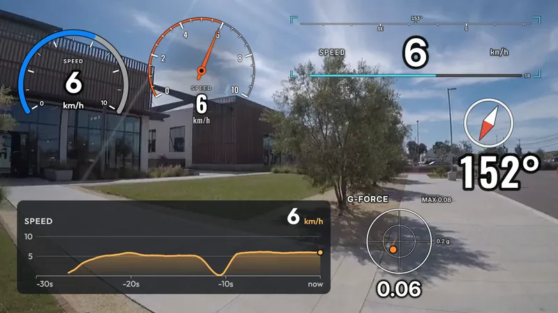
Widgets
Speed, heading, altitude, G-force, lap times, car gauges — anywhere on the picture, in your own colours.
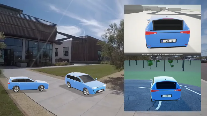
Map and 3D
A moving 2D and 3D map, and a 3D vehicle that moves with the recording's real data.
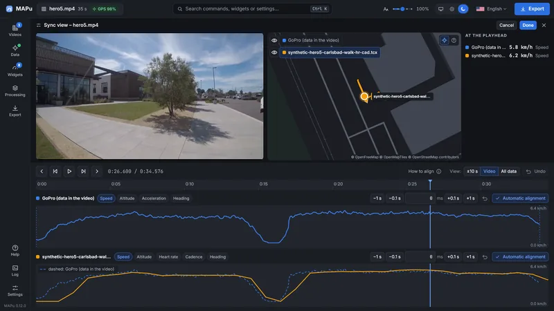
GPS and data
The camera's GPS or a data file; several sources on one video, timed automatically.